Safe Kayaking in Copano Bay
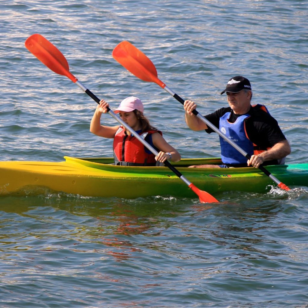
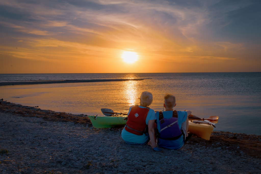
Kayaking Safely in Copano Bay: A Guide for Aransas County Paddlers Copano Bay offers some of the most beautiful paddling experiences in South Texas. With its diverse ecosystem, abundant wildlife, and stunning views, it’s no wonder kayakers are drawn to these waters. However, to fully enjoy all that Copano Bay has to offer, safety must be your top priority. This guide will help you prepare for a safe and enjoyable kayaking adventure in Aransas County. Understanding Copano Bay’s Environment Copano Bay is a shallow estuary covering approximately 65 square miles in Aransas County. Its average depth of 3-4 feet makes it ideal for kayaking, but also means weather conditions can change water conditions rapidly. The bay is home to diverse marine life, including redfish, speckled trout, and blue crabs, as well as numerous bird species that make the Texas Coastal Bend famous among birdwatchers. Essential Safety Considerations Weather Awareness Wind Conditions: Perhaps the most critical factor for kayakers in Copano Bay is wind. South Texas coastal winds can be unpredictable and intense, especially in the afternoons. A calm morning can quickly transform into challenging paddling conditions. Heat and Sun Exposure: South Texas sun is particularly intense, and the water’s reflective surface amplifies UV exposure. Essential Safety Equipment Personal Flotation Devices (PFDs): Texas law requires all kayakers to have a Coast Guard-approved PFD on board, but at Copano Bay, wearing it at all times is strongly recommended regardless of your swimming ability. Modern PFDs are designed for comfort while paddling. Communication Tools: Navigation and Visibility: Paddling Best Practices The Buddy System: Kayaking with a companion dramatically increases safety on Copano Bay. Solo paddling, while peaceful, increases risk if something goes wrong. A paddling partner can: Time Management: Be aware of sunset times, which vary significantly throughout the year in South Texas. Plan to be off the water well before dark unless you’re specifically prepared for night paddling with appropriate lights and experience. Skills Assessment: Honestly evaluate your paddling abilities and choose routes that match your skill level. Copano Bay offers something for everyone: Local Hazards to Watch For Launch Sites from Aransas Pathways Aransas Pathways maintains several excellent kayak launch sites around Copano Bay, giving paddlers multiple options to explore this beautiful ecosystem: Each site offers unique paddling experiences and access to different parts of the bay. Visit the Aransas Pathways website for specific directions and facilities information for each launch location. Final Safety Reminders Kayaking safely in Aransas County and Copano Bay means staying vigilant about changing conditions. Always watch for increasing winds, protect yourself from the intense South Texas sun, and wear your PFD consistently. Be mindful of sunset times and plan your trip accordingly. We strongly recommend paddling with a buddy system to ensure someone is always watching your back on the water. Remember that winds typically increase in the afternoon, so plan to be in protected waters or heading back to shore as the day progresses. With proper preparation and respect for the environment, kayaking Copano Bay can be one of the most rewarding outdoor experiences Aransas County has to offer. The stunning wildlife, peaceful waters, and natural beauty create memories that will last a lifetime – all while staying safe on the water.
Howard Murph Memorial Park
4701 Loop 1781, Rockport, TX 78382 28°05’44.0″N 97°03’05.2″W (see map) Species – Greater Roadrunner, American Oystercatcher, Spotted Sandpipers, Caspian, Royal, and Forster’s Terns, assorted Sparrows in winter, Osprey, Little Blue Heron, Green Heron, Reddish Egret Left in its natural state the shoreline of the park is covered with oyster shell fragments and the shallow water has sandy and seagrass beds great for fishing and wading into the shallow water. The spot also makes for a great kayak launch site. The Park also has BBQ pits and covered seating for you to enjoy. Alligator Warning – We will warn you though that there have been spotting of coastal alligators in the area. Please keep an eye out if you decide to walk out. Howard Murph Memorial Park Site is also known as the Airport Park. Directions: FM 1781, directly behind the Aransas County Airport. This is a small park with access to Copano Bay. There are picnic facilities at this site. Howard Murph Park is an excellent location for enjoying sunsets, birdwatching, kayaking, fishing, and unwinding in a peaceful environment with picnic tables and benches.
Hwy 188 Bridge
2820 SH 188 Taft, TX 78390 27.99898 -97.16908 (see map) The kayak launch site at Port Bay on Highway 188 is a convenient spot for paddlers to begin their adventure on the water. Located at the northern end of the 188 bridge over Port Bay just North West of Rockport, the launch site offers easy access to local waters of the bay, which are perfect for kayaking. The launch area is maintained by Aransas Pathways and features a gravel shoreline that makes it easy for kayakers to launch their boats. There are ample parking spaces available near the launch site, making it convenient for visitors to park their vehicles and transport their kayaks to the water’s edge. Wade fishing is also available on the North side of the bay. Kayakers can explore the calm waters of Port Bay, which is home to a variety of saltwater fish. Overall, the kayak launch site at Port Bay on Highway 188 is an excellent spot for paddlers of all levels to begin their adventure on the water.
Swan Lake
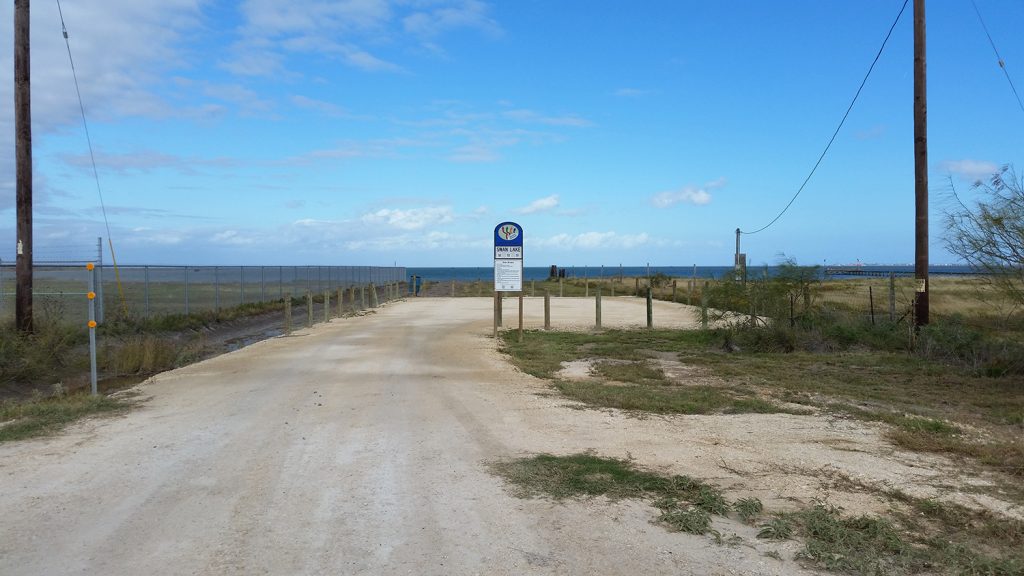
1250 Copano Retreat Rd, Taft, TX 78390 (see map) Swan Lake Kayak launch site is a popular spot for kayaking and canoeing enthusiasts, located on Copano Retreat Road in Taft, TX. Copano Retreat Road is located off of TX Highway 188, 4 miles Northwest of 35 Bypass Rockport, TX. The launch site provides access to the North East area of Port Bay, which is a shallow saltwater body of water surrounded by marshlands. The launch site features ample parking space for vehicles and trailers. There is a 50 yard hard surface path from the parking lot to the water. In addition to kayaking and canoeing, Swan Lake also offers excellent opportunities for fishing, bird watching, and wildlife viewing. Visitors can expect to see a variety of waterfowl, shorebirds, and other wildlife in their natural habitats. Overall, Swan Lake Kayak launch site on Copano Retreat Road is a great destination for anyone looking to experience the natural beauty of the Texas coast while enjoying outdoor recreational activities.
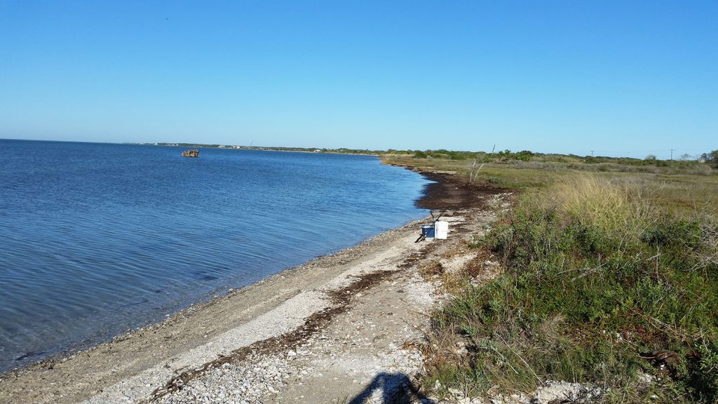
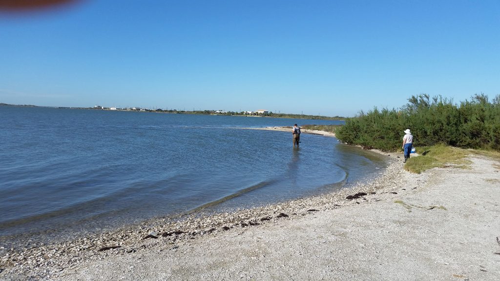
Port Bay Road
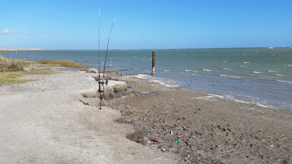
490 Port Bay Club Rd, Rockport, TX 78382 (see map) PORT BAY ROAD This site is located at the north west end of Port Bay road off of Farm to Market Road 1069. It is an existing public access site to this part of Port Bay. Most of Port Bay Road is a fair weather access road and is subject to rutting in rainy weather. This area of Port Bay is known as a good winter fishing area.
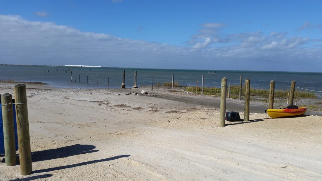
Airport Road
1240 Airport Road Rockport, TX 78382 28.095476 -97.051243 (see map) Located at the northwest end of Airport road where it intersects with Copano Bay with excellent access to Copano Bay. The site is only a short distance from Rockport-Fulton with a hard surface driveway and parking area. Shoreline access is through a short trail from the parking area. Kayaks can be launched from the shore which also provides great shoreline or wade-fishing and birdwatching. The area along the shoreline north of here is undeveloped as it is part of the Aransas County Airport property.
Rockport Beach Park

319 Broadway St, Rockport, TX 78382 (see map) Common Species – This is a nesting area for many birds. Some of the nesting birds include Black Skimmer, TriColored Heron, Reddish Egret, Great Blue Heron, Least Tern, Laughing Gull, Killdeer, and Clapper Rail Spring and Summer Species – Black Tern, Magnificent Frigatebird Winter Species – American White Pelican, Merlin, large flocks of Avocets Residents – Caspian, Royal, and Forster’s Tern, Roseate Spoonbill, Brown Pelican, Black Skimmer, Reddish Egret Rockport Beach Park Directions – Seabreeze Drive. This is a pay area with Little Bay to the left and Aransas Bay to the right. At the end of the park there is an observation platform overlooking Bird Island, which is spectacular in the spring with numerous nesting birds. This is an important nesting site of the Black Skimmer.
Copano Bay (Causeway) North
28 8.1202, -97 0.6131 (see map) Copano Bay (Causeway) North AKA North LBJ CAUSEWAY Located at the Northwest end of the LBJ Causeway over Copano Bay, this site has a limited shell parking space and access to the North shoreline of Copano Bay. This area is one of the few launches protected from a North wind and has access to a few birding sites along the shoreline.
Goose Island State Park Fishing Pier
202 S. Palmetto, Rockport, TX 78382 (see map) Goose Island St. Park Fishing Pier Located at the West end of the Fishing Pier on Goose Island, this is an excellent beginners launch area. Protected from the prevailing SE wind it affords access to fishing and birding.
Lamar – St. Charles Bay Boat Launch

175 Lamar Beach Rd, Rockport, TX 78382 (see map) 28°08’32.6″N 96°58’35.3″W Lamar Navigation District Dock AKA St. Charles Bay Boat Launch – Located on the East side of Lamar Beach road on Lamar Peninsula just South of Fourth Street, this site affords access to the West side of St. Charles Bay for fishing and birding. Located just off shore are shell reefs that attract birds and fish. The Aransas County Navigation District owns and manages this site and is willing to make a special access point for kayakers. Adequate parking is in place. Fishing just off the South end of the launch is a pier that has a shell reef 30 yards off the end.