“Tule Marsh East – Demo Garden and Wetlands Re-Dedication”

Dear Friend of Aransas Pathways,On behalf of the Aransas Pathways Steering Committee, I would like to extend this invitation to the: “Tule Marsh East – Demo Garden and Wetlands Re-Dedication” Wednesday September 14, 10a.m. As Part of the HummerBird Celebration, Aransas Pathways is pleased to announce completion of renovations of the Tule March East (Rockport Demo Garden and Wetlands Pond) The ceremony will take place behind the Demo Garden at the classroom-style pavilion, on the east side of Hwy 35 North (Across from K-Bob in Rockport). The Pathways team completed improvements to the property including replacing an entire section of the boardwalk, adding interpretive signs, and also adding a new well with a solar pump and panels. This will allow water to be pumped over to a pond area during drought periods ensuring that the birds will continue to have a source for water. Attendees may park at the entrance of the property and over flow will be transported by golf cart from the K-Bob’s Restaurant and Walmart parking lot. We Look forward to seeing you there! Sincerely, Sandy Jumper Director of Tourism and Events Rockport-Fulton Chamber of Commerce Aransas Pathways Steering Committee Member
Stewards of Nature

“Stewards of Nature“ Opening 10-September-2016 through 12-November 2016 The Friends of the History Center are delighted to present an exhibit about “Stewards of Nature.” Your friends and neighbors will be showcased in posters and programs that relate their efforts that have restored and preserved our precious coastal environment. The exhibit will open Saturday, September 10 with remarks at 6:00 PM at the History Center, 801 E. Cedar St. The exhibit is free and open to the public on Fridays and Saturdays 10 AM – 2 PM with programs on designated Sundays at 2:00 PM. Photos courtesy Diane Nunley and Jeff Adams (USFWS) Click here to view videos and photos from the exhibit opening – 10-Sep-2016
New Birds and Plants Lists posted for Castro Nature Sanctuary
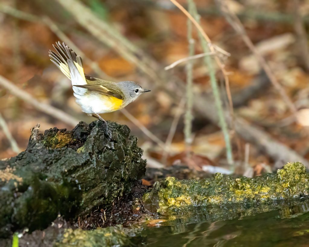
After a lot of hard work identifying, confirming, and double checking new and revised lists are available for bird species sighted and plants located at the Linda S. Castro Nature Sanctuary.
Goose Island Big Tree Route
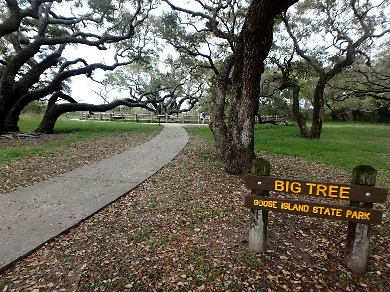
Goose Island State Park, 202 S Palmetto St, Rockport, TX 78382 (see map) On Lamar Peninsula, this cycling route begins and highlights Goose Island State Park, scenic St. Charles Bay and historic Big Tree. Approximately 6.75 miles When cycling in Aransas County, as is the case on any public street, always wear a helmet and bright, highly visible clothing. It is also recommended to have a flashing red safety light mounted behind the saddle. Always ride with the flow of traffic, unless routes converge with sidewalks, and please obey all traffic laws and regulations. GREEN – HIGH EASE OF USE: Bike lanes, wide curbed lanes or low traffic volume residential streets. Some sidewalk connections.BLUE – MODERATE EASE OF USE: Generally low to moderate traffic volumes. May have wide outer lane, wide shoulder or shoulder with rumble strip.RED – LOW EASE OF USE: Higher traffic volumes, or narrow lanes with narrow shoulder or no shoulder, difficult connections for some cyclists. This link will download a kmz file which can be read and used by Google Earth to put all the Aransas Pathways Bike Trails on your map. Click here to download. Google Earth streams the world over wired and wireless networks enabling users to virtually go anywhere on the planet and see places in photographic detail. This is not like any map you have ever seen. This is a 3D model of the real world, based on real satellite images combined with maps, guides to restaurants, hotels, entertainment, businesses and more. You can zoom from space to street level instantly and then pan or jump from place to place, city to city, even country to country.Get Google Earth. Put the world in perspective.Google Earth is available here.
Fulton Harbor Route
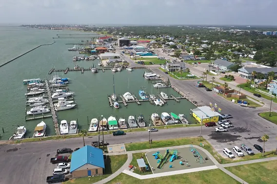
402 N Fulton Beach Rd, Fulton, TX 78358 (see map) Beginning at Fulton Harbor Park, this route highlights Aransas Bay, Copano Bay, Howard Murph Park and Fulton Harbor. Approximately 11.5 miles When cycling in Aransas County, as is the case on any public street, always wear a helmet and bright, highly visible clothing. It is also recommended to have a flashing red safety light mounted behind the saddle. Always ride with the flow of traffic, unless routes converge with sidewalks, and please obey all traffic laws and regulations. GREEN – HIGH EASE OF USE: Bike lanes, wide curbed lanes or low traffic volume residential streets. Some sidewalk connections.BLUE – MODERATE EASE OF USE: Generally low to moderate traffic volumes. May have wide outer lane, wide shoulder or shoulder with rumble strip.RED – LOW EASE OF USE: Higher traffic volumes, or narrow lanes with narrow shoulder or no shoulder, difficult connections for some cyclists. This link will download a kmz file which can be read and used by Google Earth to put all the Aransas Pathways Bike Trails on your map. Click here to download. Google Earth streams the world over wired and wireless networks enabling users to virtually go anywhere on the planet and see places in photographic detail. This is not like any map you have ever seen. This is a 3D model of the real world, based on real satellite images combined with maps, guides to restaurants, hotels, entertainment, businesses and more. You can zoom from space to street level instantly and then pan or jump from place to place, city to city, even country to country.Get Google Earth. Put the world in perspective.Google Earth is available here.
Rockport Beach Route
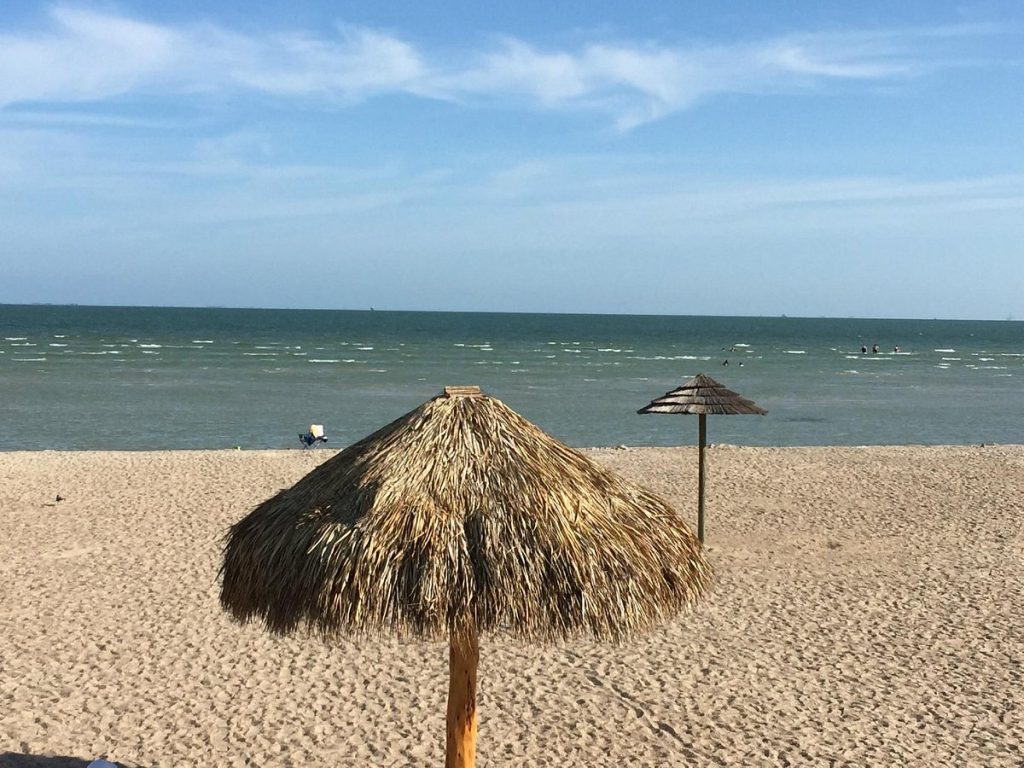
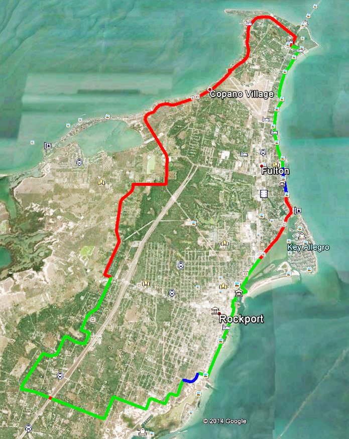
319 Broadway St,, Rockport, TX 78382 (see map) Beginning at Rockport Beach Park, this route highlights Rockport Beach, Rockport Harbor, downtown Rockport, historic Water Street, Tule Creek Hike & Bike Trail and scenic Key Allegro on Aransas Bay. Approximately 13.5 miles. When cycling in Aransas County, as is the case on any public street, always wear a helmet and bright, highly visible clothing. It is also recommended to have a flashing red safety light mounted behind the saddle. Always ride with the flow of traffic, unless routes converge with sidewalks, and please obey all traffic laws and regulations. GREEN – HIGH EASE OF USE: Bike lanes, wide curbed lanes or low traffic volume residential streets. Some sidewalk connections.BLUE – MODERATE EASE OF USE: Generally low to moderate traffic volumes. May have wide outer lane, wide shoulder or shoulder with rumble strip.RED – LOW EASE OF USE: Higher traffic volumes, or narrow lanes with narrow shoulder or no shoulder, difficult connections for some cyclists. This link will download a kmz file which can be read and used by Google Earth to put all the Aransas Pathways Bike Trails on your map. Click here to download. Google Earth streams the world over wired and wireless networks enabling users to virtually go anywhere on the planet and see places in photographic detail. This is not like any map you have ever seen. This is a 3D model of the real world, based on real satellite images combined with maps, guides to restaurants, hotels, entertainment, businesses and more. You can zoom from space to street level instantly and then pan or jump from place to place, city to city, even country to country.Get Google Earth. Put the world in perspective.Google Earth is available here.
Live Oak Peninsula Route
Loop 1781, Rockport, TX 78382 28°05’44.0″N 97°03’05.2″W (see map) Beginning at Howard Murph Park, this route encompasses most of Live Oak Peninsula and incorporates many of the sights and experiences found in the Fulton Harbor and Rockport Beach routes. Approximately 25 miles When cycling in Aransas County, as is the case on any public street, always wear a helmet and bright, highly visible clothing. It is also recommended to have a flashing red safety light mounted behind the saddle. Always ride with the flow of traffic, unless routes converge with sidewalks, and please obey all traffic laws and regulations. GREEN – HIGH EASE OF USE: Bike lanes, wide curbed lanes or low traffic volume residential streets. Some sidewalk connections.BLUE – MODERATE EASE OF USE: Generally low to moderate traffic volumes. May have wide outer lane, wide shoulder or shoulder with rumble strip.RED – LOW EASE OF USE: Higher traffic volumes, or narrow lanes with narrow shoulder or no shoulder, difficult connections for some cyclists. This link will download a kmz file which can be read and used by Google Earth to put all the Aransas Pathways Bike Trails on your map. Click here to download. Google Earth streams the world over wired and wireless networks enabling users to virtually go anywhere on the planet and see places in photographic detail. This is not like any map you have ever seen. This is a 3D model of the real world, based on real satellite images combined with maps, guides to restaurants, hotels, entertainment, businesses and more. You can zoom from space to street level instantly and then pan or jump from place to place, city to city, even country to country.Get Google Earth. Put the world in perspective.Google Earth is available here.
Aransas County Grand Tour Route
Starting Point – 121 Cove Harbor N, Rockport, TX 78382 (see map Beginning at Cove Harbor Marina, this bike route encompasses Aransas Pass, Fulton and Rockport. Points of interest along the route are Conn Brown Harbor in Aransas Pass, Howard Murph Park on Live Oak Peninsula, scenic Fulton Beach Road, the town of Fulton, historic town center of Rockport and scenic Water Street in Rockport. This entire route is an advanced ride for experienced cyclists, and many of the highlights of this ride can be found in the shorter routes designed for Aransas Pathways cyclists. Approximately 40 miles When cycling in Aransas County, as is the case on any public street, always wear a helmet and bright, highly visible clothing. It is also recommended to have a flashing red safety light mounted behind the saddle. Always ride with the flow of traffic, unless routes converge with sidewalks, and please obey all traffic laws and regulations. GREEN – HIGH EASE OF USE: Bike lanes, wide curbed lanes or low traffic volume residential streets. Some sidewalk connections.BLUE – MODERATE EASE OF USE: Generally low to moderate traffic volumes. May have wide outer lane, wide shoulder or shoulder with rumble strip.RED – LOW EASE OF USE: Higher traffic volumes, or narrow lanes with narrow shoulder or no shoulder, difficult connections for some cyclists. This link will download a kmz file which can be read and used by Google Earth to put all the Aransas Pathways Bike Trails on your map. Click here to download. Google Earth streams the world over wired and wireless networks enabling users to virtually go anywhere on the planet and see places in photographic detail. This is not like any map you have ever seen. This is a 3D model of the real world, based on real satellite images combined with maps, guides to restaurants, hotels, entertainment, businesses and more. You can zoom from space to street level instantly and then pan or jump from place to place, city to city, even country to country.Get Google Earth. Put the world in perspective.Google Earth is available here.
Connie Hagar
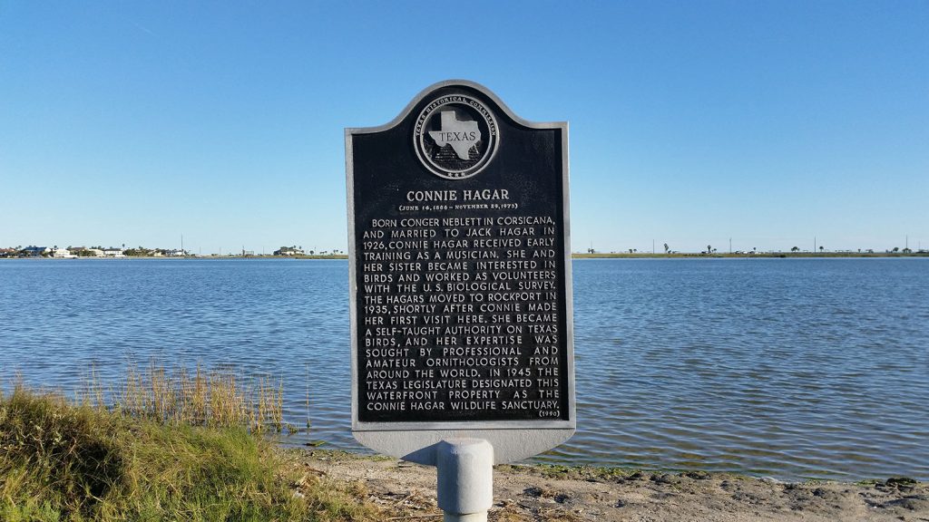
East of SH 35 (Broadway Street) at “Y” intersection, waterfront property facing Connie Hagar Wildlife Sanctuary, Rockport, TX 78382 (see map) MARKER TEXT (June 14, 1886 – November 29, 1973) Born Conger Neblett in Corsicana, and married to Jack Hagar in 1926, Connie Hagar received early training as a musician. She and her sister became interested in birds and worked as volunteers with the U.S. Biological Survey. The Hagars moved to Rockport in 1935, shortly after Connie made her first visit here. She became a self-taught authority on Texas birds, and her expertise was sought by professionals and amateur ornithologists from around the world. In 1945 the Texas Legislature designated this waterfront property as the Connie Hagar Wildlife Sanctuary. (1990)
First Baptist Church of Rockport
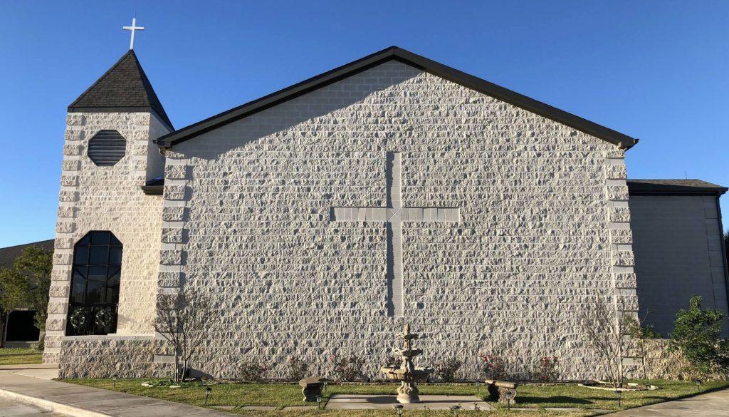
1515 N. Live Oak, Rockport, TX 78382 (see map) MARKER TEXT Organized in 1873, the First Baptist Church of Rockport originally was located on S. Church Street. L. D. Young served as the first pastor. The hurricane of 1919 destroyed the first church building, but the members built a new structure at the corner of Live Oak and Main Streets the following year. They joined with Rockport’s Methodist and Episcopal congregations to form an ecumenical Sunday School. Throughout its history, the First Baptist Church of Rockport has served the community with a variety of worship, educational, and outreach programs. (1991).