Meet Jim Farnsworth: Helping Lead the Kayaking Vision of Aransas Pathways
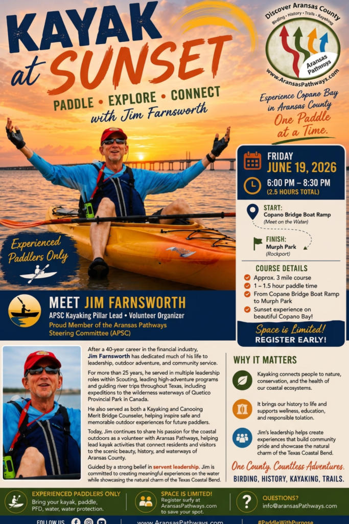
Discover the inspiring journey of Jim Farnsworth, a dedicated volunteer leader at Aransas Pathways, where kayaking transcends adventure to embrace community, conservation, and wellness. With over 25 years of experience in Scouting and outdoor education, Jim is passionate about connecting people to the stunning waterways of Aransas County. Join us as we explore how kayaking serves as a crucial pillar of Aransas Pathways, promoting sustainable tourism and enriching the coastal heritage. Dive into the stories and landscapes that make this region unique, and discover how you can be part of this transformative experience!
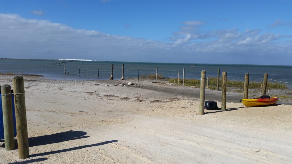
Howard Murph Memorial Park
4701 Loop 1781, Rockport, TX 78382 28°05’44.0″N 97°03’05.2″W (see map) Species – Greater Roadrunner, American Oystercatcher, Spotted Sandpipers, Caspian, Royal, and Forster’s Terns, assorted Sparrows in winter, Osprey, Little Blue Heron, Green Heron, Reddish Egret Left in its natural state the shoreline of the park is covered with oyster shell fragments and the shallow water has sandy and seagrass beds great for fishing and wading into the shallow water. The spot also makes for a great kayak launch site. The Park also has BBQ pits and covered seating for you to enjoy. Alligator Warning – We will warn you though that there have been spotting of coastal alligators in the area. Please keep an eye out if you decide to walk out. Howard Murph Memorial Park Site is also known as the Airport Park. Directions: FM 1781, directly behind the Aransas County Airport. This is a small park with access to Copano Bay. There are picnic facilities at this site. Howard Murph Park is an excellent location for enjoying sunsets, birdwatching, kayaking, fishing, and unwinding in a peaceful environment with picnic tables and benches.
Linda S. Castro Nature Sanctuary
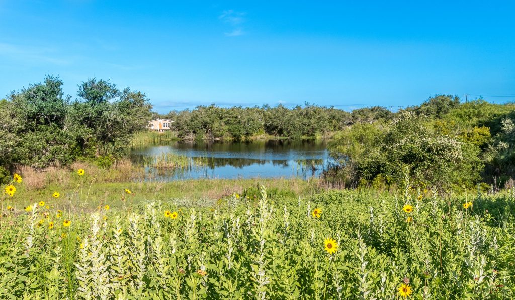
4041 Hwy 35 N., Rockport, TX 78382 (map below) This 4 1/2 acres contain 3 distinct habitats…a live oak motte, a remnant of a coastal prairie, and an ephemeral pond. A coastal Live Oak forest is special because of the native shrubs and plants that makeup the understory. This plant community, together with the Live Oaks, is called an oak motte. Oak mottes are valuable stopover habitats for migrating songbirds. This coastal prairie consists of native grasses and wildflowers. Coastal prairies provide food and shelter for many different varieties of wildlife. The plants mature in the fall and produce colorful seed heads. Standing on the slab and looking down the hill is an ephemeral pond. An ephemeral pond can be without water for a long period depending on the weather cycle. They are distinctive wetlands devoid of fish. This allows the safe development of amphibians and insects unable to withstand predation from fish. It is a Texas native plant garden. This site is a recognized Butterfly Waystation. Monarch Waystations are places that provide resources necessary for monarchs to produce successive generations and sustain their migration. Without milkweeds throughout their spring and summer breeding areas in North America, monarchs would not be able to produce the successive generations that culminate in the migration each fall. Similarly, without nectar from flowers these fall migratory monarch butterflies would be unable to make their long journey to overwintering grounds in Mexico. The need for host plants for larvae and energy sources for adults applies to all monarch and butterfly populations around the world. For more information visit – Monarch Waystation Program Check out our plant inventory at Linda S. Castro Nature Sanctuary
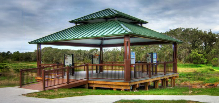
Pathways Center – Pavilion & Bridge (Tule West)
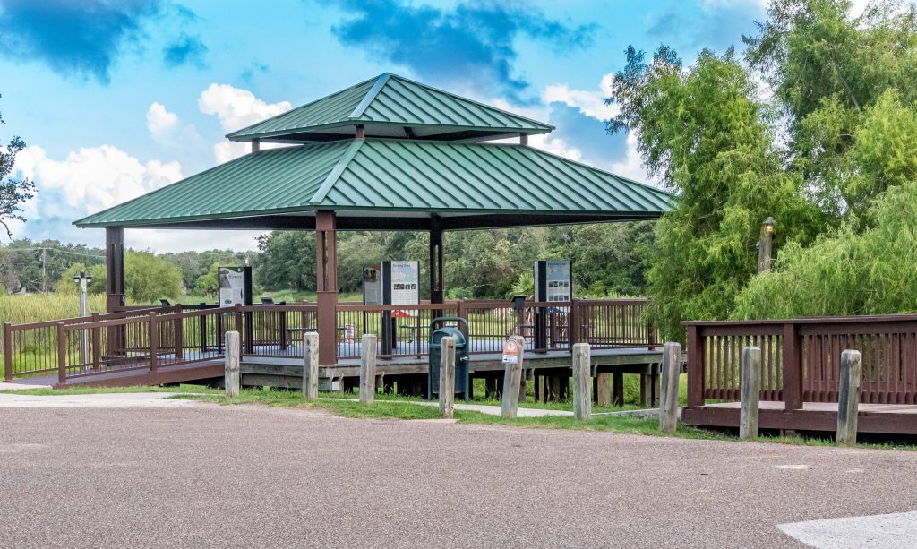
2491 Hwy 35 N., Rockport, TX 78382 (see map) The pavilion, called “Pathways Center ” is the principal information center for all of the Aransas Pathways projects. These include: Birding, History, Kayaking, and Hiking and Biking Trails. “Pathways Center” houses informational kiosks with interpretive signage explaining each Aransas Pathway project, with an open space for meetings and events. There is also a deck for relaxing and observing Tule Creek and the adjoining Shellcrete Birding and Nature site. Also known as Tule Creek West. The bridge connects the North and South sides of Tule Creek and the nature site. This facility functions as the trailhead for Pathways Eco-tourism projects in the Aransas County. Pathways Center is located on the west side of Highway 35 N and the intersection of Tule Creek. This is at the traffic light for the north entrance into Walmart. This land was leased from the City of Rockport and will serve as a birding site but will also be the information center for the Project. It includes a wooden bridge crossing Tule Creek linking the parking lot at the head of the City Hike and Bike trail to Shellcrete Historic Site and Birding Site. There is an open air pavilion with informative, interpretive signage describing the Aransas Pathways project for use by tourists and visitors. This pavilion has an excellent view of the creek and is expected to attract birders and photographers. It is also useful as a spot to stage local events and educational activities for our residents.
New Information Kiosk installed
Location: 28.023579, -97.052385, intersection of Live Oak and North streets, on the west side of the parking lot surrounding the railroad depot in downtown Rockport. (see map) Check out the new Aransas Pathways way-finding kiosk! Located in the heart of the Rockport Cultural Arts District behind the San Antonio Railroad Depot! Find your Pathway” at the brand new Aransas Pathways way-finding kiosk. Located behind the Railroad Depot in the Cultural Arts District. From the Rockport Pilot (http://www.rockportpilot.com/news/article_6e4960cc-0346-11ee-8b67-5f2c32ffea07.html): Aransas Pathways (AP) dedicated its newest information kiosk Thursday, June 1 with a ribbon cutting by the Rockport-Fulton Chamber of Commerce Bay Blazers. The new kiosk, which complements the major kiosks located at the Pathways Pavilion on Tule Creek, is located at the intersection of Live Oak and North streets, on the west side of the parking lot surrounding the railroad depot in downtown Rockport. AP Co-chairman De McLallen said the new kiosk, which directs people to AP sites, is located close to the geographic center of the county. “On behalf of AP, I thank Aransas County and the City of Rockport for all their support,” said McLallen. Aransas County Judge Ray Garza noted he started attending AP meetings about a year ago, and the concept for this new kiosk was introduced at the first meeting he attended. “Great job on the kiosk,” he said. “As simple as it is, it’s great,” he said. Pam Wheat-Stranahan said the new kiosk compliments the more detailed kiosks located at the Pathways Pavilion. “This kiosk is located on a great corridor,” she said. “We hope the AP (hike/bike trails) go from one end of the county to the other one day. That was our hope 12 years ago (when it all started).” One can take in the information found on the new kiosk, or simply take a picture of the QR code and download all pertinent AP information. “When the new courthouse and city hall are completed we want to put another one (kiosk) in Celebration Plaza,” said Wheat-Stranahan. The new kiosk should last quite a while. The current AP signs, installed up to 10-plus years ago, still look good, and are readable. “Almost all the AP signs survived Hurricane Harvey,” said McLallen.
Hwy 188 Bridge
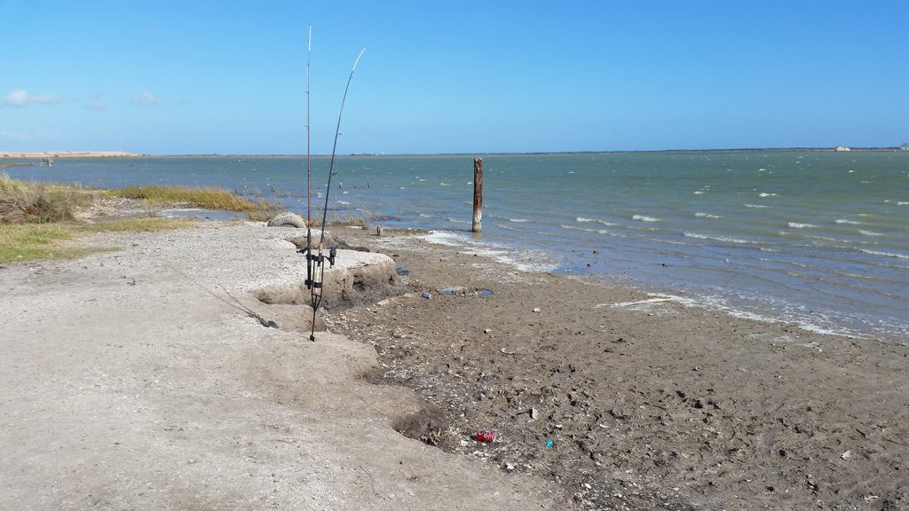
2820 SH 188 Taft, TX 78390 27.99898 -97.16908 (see map) The kayak launch site at Port Bay on Highway 188 is a convenient spot for paddlers to begin their adventure on the water. Located at the northern end of the 188 bridge over Port Bay just North West of Rockport, the launch site offers easy access to local waters of the bay, which are perfect for kayaking. The launch area is maintained by Aransas Pathways and features a gravel shoreline that makes it easy for kayakers to launch their boats. There are ample parking spaces available near the launch site, making it convenient for visitors to park their vehicles and transport their kayaks to the water’s edge. Wade fishing is also available on the North side of the bay. Kayakers can explore the calm waters of Port Bay, which is home to a variety of saltwater fish. Overall, the kayak launch site at Port Bay on Highway 188 is an excellent spot for paddlers of all levels to begin their adventure on the water.
Swan Lake
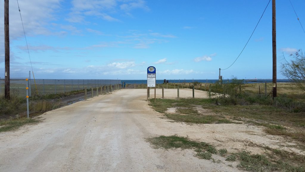
1250 Copano Retreat Rd, Taft, TX 78390 (see map) Swan Lake Kayak launch site is a popular spot for kayaking and canoeing enthusiasts, located on Copano Retreat Road in Taft, TX. Copano Retreat Road is located off of TX Highway 188, 4 miles Northwest of 35 Bypass Rockport, TX. The launch site provides access to the North East area of Port Bay, which is a shallow saltwater body of water surrounded by marshlands. The launch site features ample parking space for vehicles and trailers. There is a 50 yard hard surface path from the parking lot to the water. In addition to kayaking and canoeing, Swan Lake also offers excellent opportunities for fishing, bird watching, and wildlife viewing. Visitors can expect to see a variety of waterfowl, shorebirds, and other wildlife in their natural habitats. Overall, Swan Lake Kayak launch site on Copano Retreat Road is a great destination for anyone looking to experience the natural beauty of the Texas coast while enjoying outdoor recreational activities.
Shellcrete Birding and Nature Site
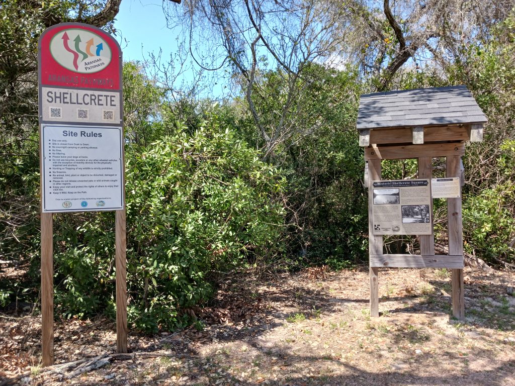
28°03’02.4″N 97°02’31.3″W (see map) 2550 Hwy 35 N, Rockport, TX 78382 Spring Species – Scarlet and Summer Tanagers, Blue Grosbeak, Rose-breasted Grosbeak, Indigo and Painted Buntings, Baltimore and Orchard Orioles, 27 species of Wood Warbler including Ovenbird, Prothonotary and Canada Warblers, Brown-crested and Great-crested Flycatchers, Solitary Sandpiper. Fall and Winter Species – American Goldfinch, Lincoln’s, Swamp, and chipping Sparrows, Orange-crowned Warbler, Pine Warbler, Yellow-rumped Warbler, Mourning Warbler, Hermit Thrush, Blue-headed Vireo. Shellcrete Birding Site Location – Shellcrete is located on Hwy 35 next to Tule Creek. This is an 11 acre wooded birding site. Tule Creek runs beside the woods. Use the parking lot at the Aransas Pathways Center – Pavilion & Bridge site (Tule West) and walk the bridge or sidewalk to access Shellcrete Birding and Nature site.
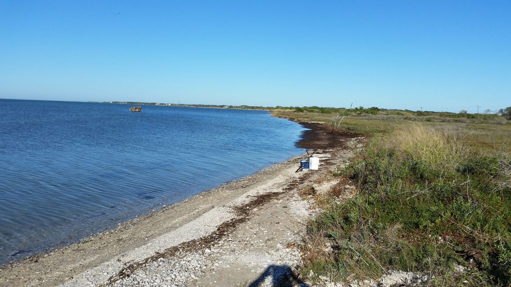
Port Bay Road
490 Port Bay Club Rd, Rockport, TX 78382 (see map) PORT BAY ROAD This site is located at the north west end of Port Bay road off of Farm to Market Road 1069. It is an existing public access site to this part of Port Bay. Most of Port Bay Road is a fair weather access road and is subject to rutting in rainy weather. This area of Port Bay is known as a good winter fishing area.
Airport Road
1240 Airport Road Rockport, TX 78382 28.095476 -97.051243 (see map) Located at the northwest end of Airport road where it intersects with Copano Bay with excellent access to Copano Bay. The site is only a short distance from Rockport-Fulton with a hard surface driveway and parking area. Shoreline access is through a short trail from the parking area. Kayaks can be launched from the shore which also provides great shoreline or wade-fishing and birdwatching. The area along the shoreline north of here is undeveloped as it is part of the Aransas County Airport property.